
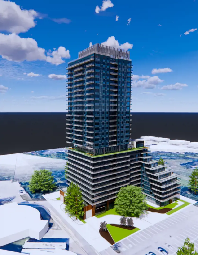
1256 Markham Road - Phase 1 project imagery

1256 Markham Road - Phase 1 / Neighbourhood guide

Toronto · A CLOSER LOOK

1256 Markham Road - Phase 1
location & neighbourhood.

The daily stops. The local connections.
The details that help you choose a home.

By Team AroraLocation data supplied by Local Logic
Project imagery · Renderings are illustrative

01 / THE SETTING

1256 Markham Road - Phase 1 location:
Toronto.

Part of the Greater Toronto Area metropolitan area, Woburn is a neighbourhood within Toronto, Ontario.

1256 Markham Rd, Scarborough, ON M1H 3B4, Canada. The address reference does not establish a final entrance or the location of an individual home.

1256 Markham Road - Phase 1 prices & floor plans ↗

Location reference

Toronto

1256 Markham Rd, Scarborough, ON M1H 3B4, Canada

Provider neighbourhood

Woburn

Provider labels may differ from builder descriptions.

Your next step

Explore nearby

Compare the places and connections that matter to your day.

1256 Markham Road - Phase 1 supplied project rendering
Project imagery, rather than a photograph of nearby amenities. Renderings are illustrative.

A NEIGHBOURHOOD IN CONTEXT

Start with how
you spend your day.

Those who enjoy a vibrant atmosphere and spending time outdoors will feel at home in Woburn. Although the ambience is not the liveliest in this part of the city, its main streets are still quite lively, and with its a few bars, there are options for nighttime activities. However, greenery is present in this part of Toronto; there are over 50 green spaces nearby for residents to enjoy, including Thomson Memorial Park and Seven Oaks Park, and they are very well-situated, which results in them being very easy to access from numerous locations in Woburn. Residents will also find that there are many tree-lined streets.

Read the full neighbourhood profile

Getting around

This part of Toronto permits homeowners to move around using different modes of transportation. Walking is reasonably feasible for property owners in Woburn; running daily errands is convenient without needing to get in a vehicle, and there are also a good number of businesses nearby. The bike is a good means of transportation in Woburn. With around 30 nearby bus lines, the transit network in Woburn is convenient. The car is usually the favoured method to navigate this neighbourhood. Many properties for sale are a rather short drive from the nearest highway, such as Highway 401, and it is easy to access a place to park.

Everyday essentials

Daycares and schools are straightforward to get to as a pedestrian from most properties for sale in this part of the city. When it comes to food, the nearest supermarket in Woburn is generally only a short stroll away. Likewise, there is usually a restaurant or cafe in close proximity. It is also very easy to get to a number of clothing stores without needing a car.

Local character

Those who enjoy a vibrant atmosphere and spending time outdoors will feel at home in Woburn. Although the ambience is not the liveliest in this part of the city, its main streets are still quite lively, and with its a few bars, there are options for nighttime activities. However, greenery is present in this part of Toronto; there are over 50 green spaces nearby for residents to enjoy, including Thomson Memorial Park and Seven Oaks Park, and they are very well-situated, which results in them being very easy to access from numerous locations in Woburn. Residents will also find that there are many tree-lined streets.

Surrounding homes

In Woburn, many dwellings are large apartment buildings, and the rest are mainly single detached homes. This neighbourhood has a good variety of unit sizes, ranging from lofts to four or more bedrooms. The split between renters and homeowners is about even. Around one third of homes in this area were constructed between 1960 and 1980, while most of the remaining buildings were built pre-1960 and in the 1990s.

02 / LOCATION SCORES

1256 Markham Road - Phase 1
neighbourhood scores.

Explore how local access and character compare with your priorities. These Local Logic scores describe the recorded project location on a scale of 0 to 5.

Higher scores indicate stronger access or more of the named characteristic. A missing score is unavailable, rather than zero.

High schools

5.0/ 5

At least one high school within a 5-minute walk

Toronto: 4.2 / 5

Elementary schools

5.0/ 5

At least one elementary school within a 5-minute walk

Toronto: 4.7 / 5

Public transit

3.9/ 5

Walking distance to at least one frequent transit route

Toronto: 4.3 / 5

Groceries

4.3/ 5

Wide variety of groceries within a few minutes' walk

Toronto: 4.3 / 5

Wellness

3.7/ 5

Variety of amenities nearby promoting health and activity

Toronto: 3.9 / 5

Restaurants

3.8/ 5

Wide variety of restaurants within a short drive, including some within walking distance

Toronto: 3.9 / 5

Walking

1.9/ 5

A few pedestrian-oriented shops within walking distance. Meeting daily needs on foot is not often practical or pleasant

Toronto: 3.9 / 5

Greenery

2.7/ 5

Some trees on the street, with some parks nearby

Toronto: 3.1 / 5

Cycling

2.5/ 5

Somewhat suitable for bicycle commuting and/or recreational cycling

Toronto: 3.3 / 5

Driving

5.0/ 5

Exceptional access to freeways and/or major arteries, with almost no chance of parking problems

Toronto: 3.2 / 5

Vibrancy

1.8/ 5

Calm atmosphere most of the day

Toronto: 2.1 / 5

Shopping

4.1/ 5

Wide variety of shops within a few minutes' walk

Toronto: 4.1 / 5

Childcare

4.8/ 5

At least one daycare within a very short walk

Toronto: 4.7 / 5

Nightlife

3.1/ 5

Wide variety of bars within a short drive, including some within walking distance

Toronto: 2.5 / 5

Cafés

4.2/ 5

Wide variety of cafés within a few minutes' walk

Toronto: 3.8 / 5

Quiet

0.0/ 5

Many sources of noise nearby

Toronto: 3.0 / 5

Parks

4.8/ 5

Exceptionally large amount of park space within a few minutes' walk

Toronto: 5.0 / 5
Project referenceToronto comparison, where suppliedSources & notes ↗

03 / EXPLORE NEARBY

1256 Markham Road - Phase 1 nearby
amenities.

Find nearby schools, transit, parks and everyday stops. Browse the directory, then open directions for the actual route.

Places and distances are tied to the recorded project reference. Directories contain the provider’s returned results and are not exhaustive.

181 places shown · straight-line distances

Schools nearby

18 places
High school / Elementary school315 m

Z3 Education Centre

1200 Markham M1H 3C3

online/site based, all year round

Get directions
High school384 m

Talenta Academy

2020 Ellesmere Road

site based, all year round

Get directions
High school530 m

Woburn Collegiate Institute

2222 Ellesmere Rd

9-12 · Toronto District School Board

Get directions
Explore all 18 schools places
Elementary school645 m

Woburn Junior Public School

40 Dormington Dr

JK-6 · Toronto District School Board

Get directions
Elementary school744 m

St Thomas More Catholic School

2300 Ellesmere Rd

JK-8 · catholic · Toronto Catholic District School Board

Get directions
Elementary school771 m

Advanced Christian Academy

1100 Bellamy Rd N

site based

Get directions
Elementary school801 m

Bellmere Junior Public School

470 Brimorton Dr

JK-6 · Toronto District School Board

Get directions
Elementary school1.0 km

New Covenant Church School

1800 Ellesmere Rd

site based

Get directions
Elementary school1.0 km

Churchill Heights Public School

749 Brimorton Dr

JK-8 · Toronto District School Board

Get directions
High school / Elementary school1.1 km

Madinatul Uloom Academy - Scarborough

670 Progress Avenue

online/site based, all year round

Get directions
Elementary school1.1 km

Al Haadi (9828770 Canada Institute)

690 Progress Avenue

site based

Get directions
Elementary school1.2 km

St Richard Catholic School

960 Bellamy Rd N

JK-8 · catholic · Toronto Catholic District School Board

Get directions
High school1.3 km

Madinatul-Uloom Academy

670 Progress Ave

online/site based, all year round

Get directions
High school1.7 km

Innunco Academy

5200 Yonge Street

online/site based, all year round

Get directions
High school1.7 km

Northway Collegiate

700-55 Town centre court

online/site based, all year round

Get directions
High school1.9 km

Canadian Tamil Academy

8 Milner Avenue

online/site based, all year round

Get directions
High school2.3 km

Alternative Scarborough Education 1

45 Windover Drive

9-12 · Toronto District School Board

Get directions
High school2.3 km

Al-Madrasah Al-Inamiyyah Private School

3665 Lawrence Avenue East

site based

Get directions

Transit nearby

30 places
Explore all 30 transit places

Dining nearby

49 places
Explore all 49 dining places

Parks nearby

30 places
Explore all 30 parks places

Daily essentials nearby

54 places
Explore all 54 daily essentials places

04 / THE SURROUNDING COMMUNITY

Woburn
demographics.

Who lives around the recorded project location? These statistics describe the existing population in Local Logic’s 400-metre study area.

This is neighbourhood context, rather than a prediction of who will buy at 1256 Markham Road - Phase 1. Underlying census reference years are not supplied in this view.

Average household income

$82,265

Residents in the study area

1,792

Owner households

28.7%

Commute on foot

3.8%

Population age

0 to 4
5.6%
5 to 9
6.1%
10 to 14
5.8%
15 to 19
5.6%
20 to 34
28.9%
35 to 49
19.6%
50 to 64
17.1%
65 to 79
8.3%
80 and over
3.1%

Housing type

Apartment 5 or more floors
83.9%
Single detached
9.3%
Duplex
3.3%
Row houses
2.5%
Apartment 1-4 floors
0.6%
Semi detached
0.5%

Household composition

Single person
30.1%
Multi person
7.3%
Single family
61.7%
Multi family
0.9%

Commute mode

Car
64.6%
Public transit
30.6%
Foot
3.8%
Other
1.0%
Bicycle
0.1%
Explore the full demographic profile Income, education, tenure & more +

Income

Average household income
$82,265
Average individual income
$35,693

Total

Total individuals
1,792

Owners vs Renters

Renters
71.3%
Owners
28.7%

Official language knowledge

English only
91.3%
Other
4.9%
English and French
3.6%
French only
0.2%

Highest level of education achieved

Did not graduate high school
18.1%
High school
28.4%
Trade certificate
3.5%
College certificate
15.5%
University certificate
2.3%
Bachelor degree
23.5%
Post graduate degree
8.8%

Number of children per household

Average number of children per household
1.8

Mother tongue

English
43.3%
Tamil
13.5%
Gujarati
13.3%
English and non-official language(s)
10.3%
Urdu
4.2%
Bengali
3.0%
Tagalog (Pilipino, Filipino)
2.6%
Dari
2.4%
Yue (Cantonese)
2.3%
Malayalam
1.8%
Mandarin
1.7%
Hindi
1.5%
Punjabi (Panjabi)
0.1%

Percentages and counts retain the provider’s definitions. Some categories describe different populations or overlap, so they should not be combined into a single total.

05 / PLAN WITH CONFIDENCE

Schools near 1256 Markham Road - Phase 1:
check the boundaries.

The nearby directory is a useful starting point. Distance to a school does not establish attendance eligibility, a place in a particular program or available capacity.

06 / SEE IT FOR YOURSELF

1256 Markham Road - Phase 1 address
& directions.

Explore the area at different times of day. Confirm the correct meeting location with the builder or your representative before travelling.

THE RECORDED PROJECT LOCATION

1256 Markham Rd, Scarborough, ON M1H 3B4, Canada

This pin is a project reference, rather than a confirmed community entrance or sales centre.

Get project-location directions ↗

A FEW USEFUL ANSWERS

Before you
call it home.

What do the location scores measure?

Local Logic supplies individual access and character scores on a 0–5 scale for the recorded coordinates. Consider each measure separately; we do not calculate an overall livability rating.

Are the distances walking times?

No. Distances are straight-line measurements from the project reference. Open directions to check a walking, cycling, transit or driving route.

Does a nearby school guarantee admission?

No. Confirm attendance boundaries, programs, capacity and registration requirements with the relevant school board.

Do the demographic figures describe future residents?

No. They describe the existing population in the provider’s surrounding study area. They do not predict the buyers or future residents of this project.

SOURCES & METHODOLOGY

A guide with a clear point of reference.

Prepared by Team Arora. Scores, neighbourhood descriptions, school records, places and demographic information are supplied by Local Logic. Requests are cached for up to 24 hours; underlying source periods may be older. Provider neighbourhood labels may differ from builder descriptions. Missing data remains unavailable.

Recorded coordinates: 43.77892, -79.23420999999999. Amenity queries use a 2.5 km radius; school results retain the provider’s school-search coverage. Distances use the returned straight-line measurement, or are calculated directly between coordinates when absent. The project page includes the existing map; Google provides the linked directions. Verify current place details, boundaries and routes before making a decision.