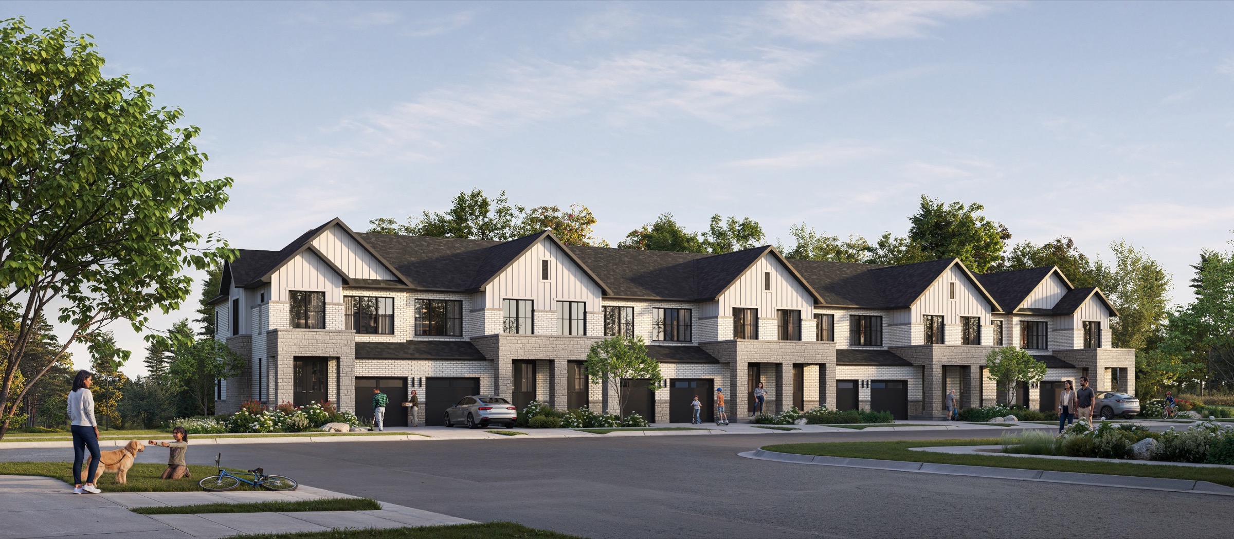
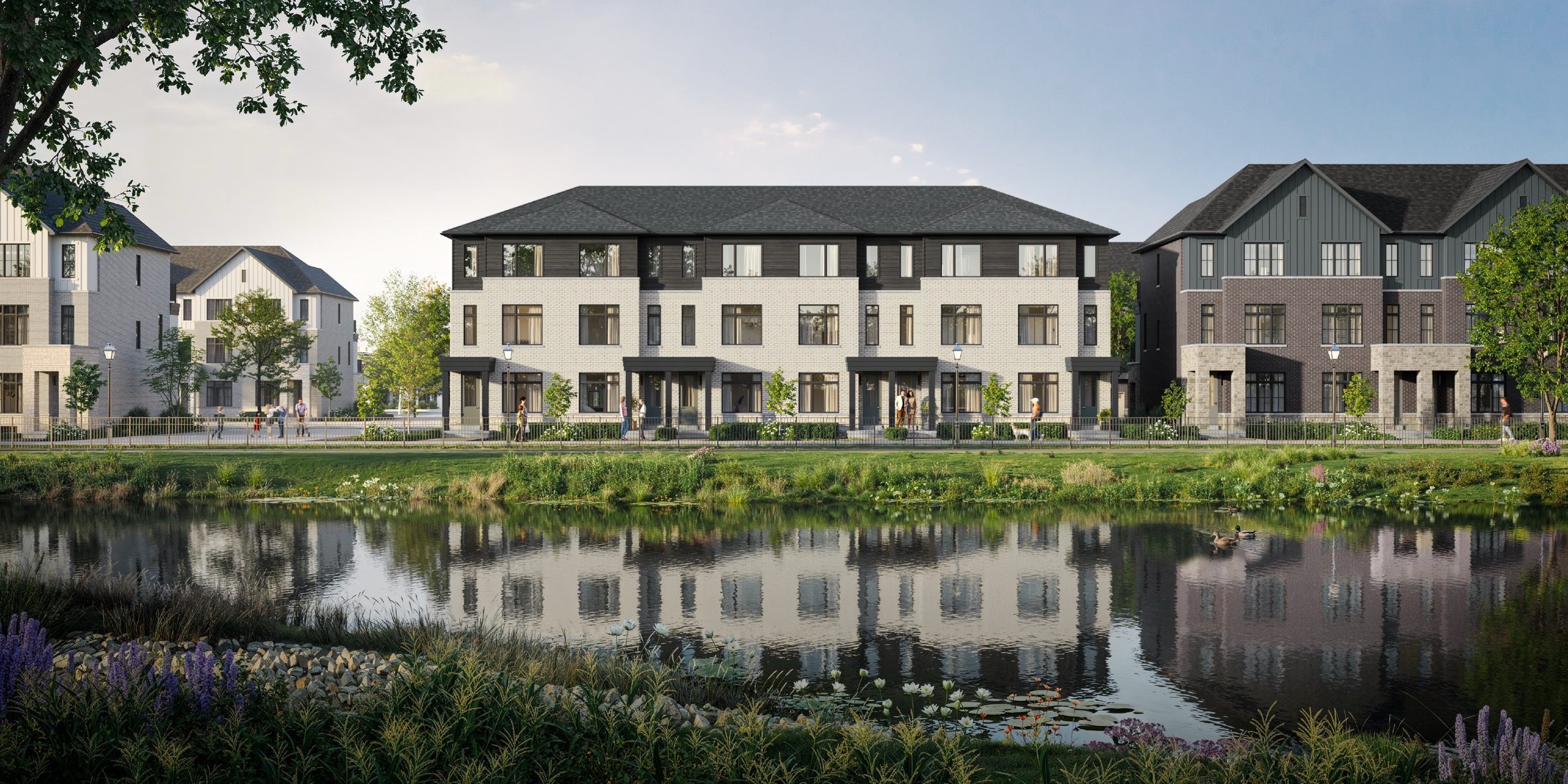
Cornerstone by Primont Homes project imagery

Cornerstone by Primont Homes / Neighbourhood guide

Brampton · A CLOSER LOOK

Cornerstone by Primont Homes
location & neighbourhood.

Project information updated: Confirm current pricing and availability with the builder.

The daily stops. The local connections.
The details that help you choose a home.

By Team AroraLocation data supplied by Local Logic
Project imagery · Renderings are illustrative

01 / THE SETTING

Cornerstone by Primont Homes location:
Brampton.

Mount Pleasant West is a neighbourhood within Brampton, Ontario, which is located in the Greater Toronto Area metropolitan area.

Mississauga Road & Wanless Drive. The address reference does not establish a final entrance or the location of an individual home.

Cornerstone by Primont Homes prices & floor plans ↗

Location reference

Brampton

Mississauga Road & Wanless Drive

Provider neighbourhood

Mount Pleasant West

Provider labels may differ from builder descriptions.

Your next step

Explore nearby

Compare the places and connections that matter to your day.

Cornerstone by Primont Homes supplied project rendering
Project imagery, rather than a photograph of nearby amenities. Renderings are illustrative.

A NEIGHBOURHOOD IN CONTEXT

Start with how
you spend your day.

Home buyers who prefer a calm ambience will enjoy Mount Pleasant West. It is very easy to reach public green spaces in the neighbourhood, since there are about 10 of them close by for residents to explore, such as Creditview Sandalwood Park. The noise levels in this part of the city are also low, as the streets tend to be quite calm.

Read the full neighbourhood profile

Getting around

Commuting by car is straightforward in this area. Finding a parking spot is easy. On the other hand, the transit system in Mount Pleasant West is not very practical. Nonetheless, there are a few bus lines passing through the neighbourhood, and the nearest bus stop is typically around the corner. Traveling as a pedestrian is not very practical for home buyers in Mount Pleasant West since few daily errands can be run without a car. In contrast, this area is fairly bicycling-friendly.

Everyday essentials

Shopping for one's groceries typically necessitates the use of a car in Mount Pleasant West. Nevertheless, it is generally a rather short distance to the closest pharmacy, which can provide some staple foods. There are also a few options for those who care about close by restaurants and cafes. Concerning education, in this area, families will typically be able to reach primary schools as pedestrians. On the other hand, Mount Pleasant West does not have any high schools.

Local character

Home buyers who prefer a calm ambience will enjoy Mount Pleasant West. It is very easy to reach public green spaces in the neighbourhood, since there are about 10 of them close by for residents to explore, such as Creditview Sandalwood Park. The noise levels in this part of the city are also low, as the streets tend to be quite calm.

Surrounding homes

The predominant housing types in Mount Pleasant West are single detached homes and townhouses. Notably, this part of Brampton is good for those looking for three bedroom homes. About 70% of the population of this neighbourhood own their home and 30% are renters. About one third of properties in this part of the city were built between 1960 and 1980, while most of the remaining buildings were constructed pre-1960 and in the 1980s.

02 / LOCATION SCORES

Cornerstone by Primont Homes
neighbourhood scores.

Explore how local access and character compare with your priorities. These Local Logic scores describe the recorded project location on a scale of 0 to 5.

Higher scores indicate stronger access or more of the named characteristic. A missing score is unavailable, rather than zero.

High schools

0.1/ 5

Closest high school further than a 30-minute walk

Brampton: 3.2 / 5

Elementary schools

3.0/ 5

At least one elementary school within a 20-minute walk

Brampton: 4.5 / 5

Public transit

1.4/ 5

Transit is available for some trips

Brampton: 2.6 / 5

Groceries

3.0/ 5

Wide variety of groceries within a short drive, including some within walking distance

Brampton: 3.8 / 5

Wellness

0.4/ 5

Few or no amenities promoting health and activity nearby

Brampton: 2.8 / 5

Restaurants

1.9/ 5

Some restaurants within a short drive

Brampton: 3.2 / 5

Walking

0.3/ 5

Very few or no pedestrian-oriented shops within walking distance. Meeting daily needs on foot is almost never practical or pleasant

Brampton: 2.6 / 5

Cycling

2.3/ 5

Somewhat suitable for bicycle commuting and/or recreational cycling

Brampton: 3.0 / 5

Driving

5.0/ 5

Exceptional access to freeways and/or major arteries, with almost no chance of parking problems

Brampton: 3.7 / 5

Vibrancy

0.5/ 5

Calm atmosphere at all hours

Brampton: 1.2 / 5

Shopping

1.5/ 5

Some shops within a short drive

Brampton: 3.2 / 5

Childcare

3.2/ 5

At least one daycare within a very short drive

Brampton: 4.3 / 5

Nightlife

0.8/ 5

Few or no bars within a short drive

Brampton: 1.3 / 5

Cafés

1.4/ 5

Some cafés within a short drive

Brampton: 2.6 / 5

Quiet

3.4/ 5

Few sources of noise nearby

Brampton: 4.4 / 5

Parks

3.2/ 5

Large amount of park space nearby

Brampton: 4.3 / 5
Project referenceBrampton comparison, where suppliedSources & notes ↗

03 / EXPLORE NEARBY

Cornerstone by Primont Homes nearby
amenities.

Find nearby schools, transit, parks and everyday stops. Browse the directory, then open directions for the actual route.

Places and distances are tied to the recorded project reference. Directories contain the provider’s returned results and are not exhaustive.

91 places shown · straight-line distances

Schools nearby

19 places
Elementary school1.0 km

Dolson Public School

95 Remembrance Road

JK-8 · french immersion, regular · Peel District School Board

Get directions
Elementary school1.2 km

St. Carlo Acutis Catholic Elementary School

320 Robert Parkinson Drive

JK-8 · catholic · Dufferin-Peel Catholic District School Board

Get directions
Elementary school1.4 km

Tribune Drive Public School

30 Tribune Drive

JK-8 · regular · Peel District School Board

Get directions
Explore all 19 schools places
Elementary school1.6 km

St. Daniel Comboni Catholic Elementary School

120 Veterans Drive

JK-8 · catholic · Dufferin-Peel Catholic District School Board

Get directions
Elementary school1.9 km

St. Aidan Catholic Elementary School

34 Buick Blvd

JK-8 · catholic · Dufferin-Peel Catholic District School Board

Get directions
Elementary school2.1 km

Brisdale Public School

370 Brisdale Dr

JK-5 · french immersion, regular · Peel District School Board

Get directions
Elementary school2.1 km

Aylesbury Public School

25 Aylesbury Drive

JK-8 · regular · Peel District School Board

Get directions
Elementary school2.2 km

St. Bonaventure Catholic Elementary School

35 McCrimmon Drive

JK-8 · catholic · Dufferin-Peel Catholic District School Board

Get directions
Elementary school2.2 km

Alloa Public School

12287 Mississauga Road

JK-8 · regular · Peel District School Board

Get directions
High school2.2 km

St Edmund Campion Secondary School

275 Brisdale Drive

9-12 · catholic · Dufferin-Peel Catholic District School Board

Get directions
Elementary school2.4 km

McCrimmon Middle School

83 McCrimmon Dr

6-8 · regular · Peel District School Board

Get directions
High school2.8 km

Fletcher's Meadow Secondary School

10750 Chinguacousy Rd

9-12 · regular · Peel District School Board

Get directions
High school2.8 km

Parkholme Secondary School

10750 Chinguacousy Road

9-12 · alternative · Peel District School Board

Get directions
High school3.2 km

Jean Augustine Secondary School

500 Elbern Markell Drive

9-12 · regular · Peel District School Board

Get directions
High school3.6 km

Green Apple Alternative School

5 Brisdale Drive

site based, all year round

Get directions
High school3.7 km

High Five Academy for Learning

611 Wanless Dr

online/site based

Get directions
High school4.2 km

Simcoe High School

100 Pertosa Drive

online/site based, all year round

Get directions
High school4.4 km

St. Roch Catholic Secondary School

200 Valleyway Drive

9-12 · catholic · Dufferin-Peel Catholic District School Board

Get directions

Transit nearby

30 places
Explore all 30 transit places

Dining nearby

10 places
Explore all 10 dining places

Parks nearby

30 places
Explore all 30 parks places

Daily essentials nearby

2 places

04 / THE SURROUNDING COMMUNITY

Mount Pleasant West
demographics.

Who lives around the recorded project location? These statistics describe the existing population in Local Logic’s 400-metre study area.

This is neighbourhood context, rather than a prediction of who will buy at Cornerstone by Primont Homes. Underlying census reference years are not supplied in this view.

Average household income

$126,900

Residents in the study area

1,277

Owner households

80.8%

Commute on foot

0.6%

Population age

0 to 4
9.9%
5 to 9
9.1%
10 to 14
7.5%
15 to 19
5.8%
20 to 34
26.3%
35 to 49
25.5%
50 to 64
10.1%
65 to 79
5.2%
80 and over
0.6%

Housing type

Single detached
66.2%
Row houses
18.4%
Semi detached
10.0%
Apartment 5 or more floors
2.9%
Duplex
2.5%
Apartment 1-4 floors
0.1%

Household composition

Single person
7.6%
Multi person
4.8%
Single family
83.4%
Multi family
4.3%

Commute mode

Car
88.1%
Public transit
8.9%
Other
2.4%
Foot
0.6%
Bicycle
0.0%
Explore the full demographic profile Income, education, tenure & more +

Income

Average household income
$126,900
Average individual income
$46,800

Total

Total individuals
1,277

Owners vs Renters

Owners
80.8%
Renters
19.2%

Official language knowledge

English only
90.5%
English and French
4.7%
Other
4.7%
French only
0.1%

Highest level of education achieved

Did not graduate high school
14.6%
High school
25.7%
Trade certificate
2.9%
College certificate
16.0%
University certificate
2.6%
Bachelor degree
26.2%
Post graduate degree
12.0%

Number of children per household

Average number of children per household
1.9

Mother tongue

English
41.0%
Punjabi (Panjabi)
24.7%
English and non-official language(s)
10.9%
Urdu
6.0%
Hindi
5.4%
Gujarati
5.2%
Tamil
3.6%
Telugu
1.4%
Spanish
1.0%
Tagalog (Pilipino, Filipino)
0.9%
French
0.0%
Italian
0.0%
Blackfoot
0.0%
Atikamekw
0.0%
Ililimowin (Moose Cree)
0.0%
Inu Ayimun (Southern East Cree)
0.0%
Iyiyiw-Ayimiwin (Northern East Cree)
0.0%
Nehinawewin (Swampy Cree)
0.0%

Percentages and counts retain the provider’s definitions. Some categories describe different populations or overlap, so they should not be combined into a single total.

05 / PLAN WITH CONFIDENCE

Schools near Cornerstone by Primont Homes:
check the boundaries.

The nearby directory is a useful starting point. Distance to a school does not establish attendance eligibility, a place in a particular program or available capacity.

06 / SEE IT FOR YOURSELF

Cornerstone by Primont Homes address
& directions.

Explore the area at different times of day. Confirm the correct meeting location with the builder or your representative before travelling.

THE RECORDED PROJECT LOCATION

Mississauga Road & Wanless Drive

This pin is a project reference, rather than a confirmed community entrance or sales centre.

Get project-location directions ↗

A FEW USEFUL ANSWERS

Before you
call it home.

What do the location scores measure?

Local Logic supplies individual access and character scores on a 0–5 scale for the recorded coordinates. Consider each measure separately; we do not calculate an overall livability rating.

Are the distances walking times?

No. Distances are straight-line measurements from the project reference. Open directions to check a walking, cycling, transit or driving route.

Does a nearby school guarantee admission?

No. Confirm attendance boundaries, programs, capacity and registration requirements with the relevant school board.

Do the demographic figures describe future residents?

No. They describe the existing population in the provider’s surrounding study area. They do not predict the buyers or future residents of this project.

SOURCES & METHODOLOGY

A guide with a clear point of reference.

Compare neighbourhood context across Brampton ↗ · Explore Brampton new-home projects ↗

Prepared by Team Arora. Scores, neighbourhood descriptions, school records, places and demographic information are supplied by Local Logic. Requests are cached for up to 24 hours; underlying source periods may be older. Provider neighbourhood labels may differ from builder descriptions. Missing data remains unavailable.

Recorded coordinates: 43.6867295, -79.8565067. Amenity queries use a 2.5 km radius; school results retain the provider’s school-search coverage. Distances use the returned straight-line measurement, or are calculated directly between coordinates when absent. The project page includes the existing map; Google provides the linked directions. Verify current place details, boundaries and routes before making a decision.